ACSL begins accepting orders for “PF2-AE Survey” YellowScan’s LiDAR Enables Laser Surveying by Domestic Drones
- Today, ACSL have started accepting orders for a new model in this lineup, the PF2-AE Survey laser surveying drone.
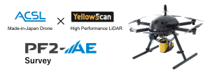
- YellowScan’s LiDAR enables high-definition laser surveying with domestically produced drones.
ACSL Ltd. (Edogawa Ward, Tokyo; Satoshi Washiya, CEO, hereafter ACSL), in August 2022, announced the PF2-AE (Advanced Edition), a new lineup of three new models designed to be easier to use and more secure※.
Today, ACSL is pleased to announce that we have started accepting orders for a new model drone in this lineup, the PF2-AE Survey. This drone will be equipped with a LiDAR manufactured by YellowScan, a leading provider of LiDAR solutions, enabling high-definition laser surveying with a domestically produced drone. With this, ACSL’s domestic drones will make a full-scale entry into the surveying field.
※Announced on July 14, 2022: https://ssl4.eir-parts.net/doc/6232/tdnet/2157226/00.pdf
■Background
Surveying is the important task of measuring the size, height, and undulations of a particular piece of land. Surveying is used in all aspects of civil engineering, construction, urban planning, and mapping. However, surveying by people using surveying equipment is very time-consuming and costly, and drones have been actively used for surveying.
The need for surveying has been growing because drones equipped with a laser scanner can reach the ground surface through trees, enabling topographic surveying even in forests before logging, and obtaining high-resolution data that cannot be obtained by photogrammetric surveying. This allows surveyors to obtain high-resolution data that cannot be obtained by photogrammetric surveying, and this has led to an increase in demand.
This is the reason why ACSL has decided to release an ACSL domestic drone equipped with YellowScan’s LiDAR, which enables higher resolution laser surveying.
■Made-in-Japan Drone PF2-AE (Advanced Edition)
The PF2-AE is a customized drone that is easier to use, based on ACSL’s research into the necessary functions and specifications for each application through a series of demonstration tests with many companies. So far, ACSL has released three models: PF2-AE Delivery, PF2-AE Inspection, and PF2-AE Disaster Relief/Patrol, and now, in response to customer demand, ACSL is pleased to announce the PF2-AE Survey. The PF2-AE Survey is equipped with a secure system developed by SOTEN to ensure security.
■YellowScan LiDAR Mapper+/Ultra2
Mapper+ and Ultra2 are compact, lightweight, general-purpose drone LiDAR measurement systems for topographic surveying and mapping in public work. Both systems are easy to operate with a single yellow button, yet are highly reliable and practical in the field, providing stable and accurate measurements. YellowScan’s original YellowScan software, CloudStation, is easy to use with Japanese menus, allowing users to check data on the job site and output highly accurate point clouds with all the documentation required for surveying operations. YellowScan is the world market leader in professional drone lidar measurement.